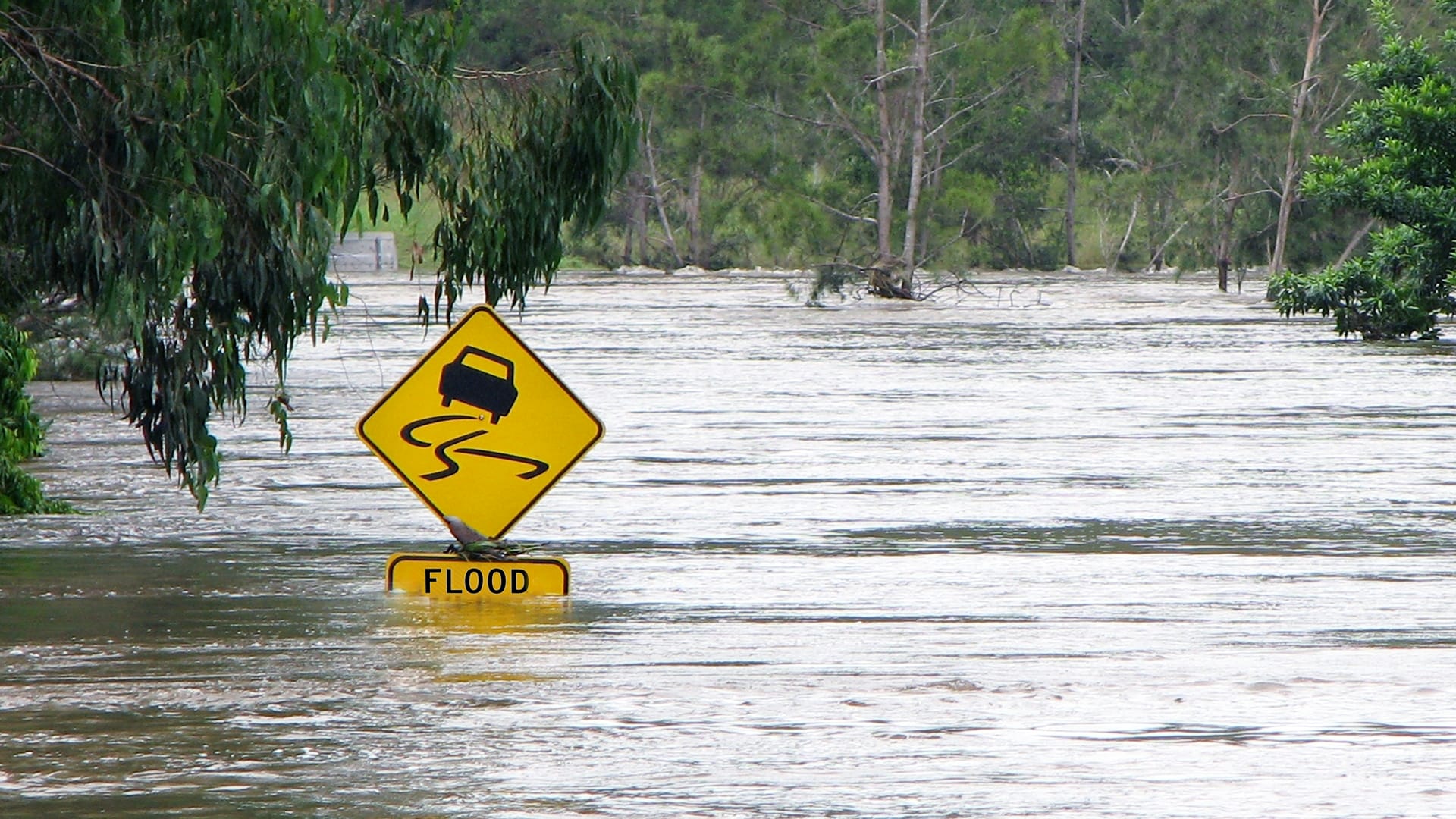
Where do flash floods happen?
Scroll for prep

Please wait…
This video is having trouble loading. You may have lost your Internet connection.
Step 1: Click to Reload this page
Step 2: Click to
Try our other video player
Step 3: contact support if trouble persists.
Or,
dismiss this message.
DISCUSS:
Can you think of reasons why one place might flood more than other places?
Please wait…
This video is having trouble loading. You may have lost your Internet connection.
Step 1: Click to Reload this page
Step 2: Click to
Try our other video player
Step 3: contact support if trouble persists.
Or,
dismiss this message.
DISCUSS:
What is the ground like where you live?
Please wait…
This video is having trouble loading. You may have lost your Internet connection.
Step 1: Click to Reload this page
Step 2: Click to
Try our other video player
Step 3: contact support if trouble persists.
Or,
dismiss this message.
DISCUSS:
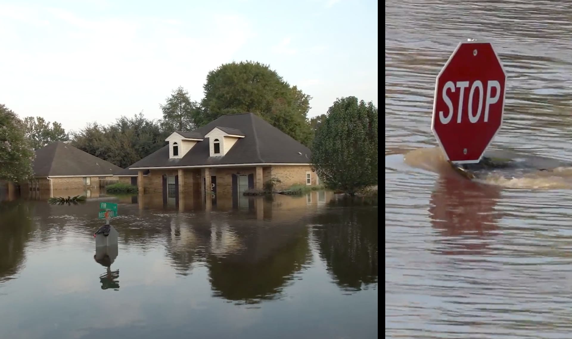
What could turn a puddle into a fast-moving river of water?
Please wait…
This video is having trouble loading. You may have lost your Internet connection.
Step 1: Click to Reload this page
Step 2: Click to
Try our other video player
Step 3: contact support if trouble persists.
Or,
dismiss this message.
DISCUSS:
How could you figure out which part of Texas gets the most flash floods?
Please wait…
This video is having trouble loading. You may have lost your Internet connection.
Step 1: Click to Reload this page
Step 2: Click to
Try our other video player
Step 3: contact support if trouble persists.
Or,
dismiss this message.
DISCUSS:
Imagine you're starting with a totally blank map of Texas.
What information would you want to add to your map to help you find Flash Flood Alley?
Please wait…
This video is having trouble loading. You may have lost your Internet connection.
Step 1: Click to Reload this page
Step 2: Click to
Try our other video player
Step 3: contact support if trouble persists.
Or,
dismiss this message.
Please wait…
This video is having trouble loading. You may have lost your Internet connection.
Step 1: Click to Reload this page
Step 2: Click to
Try our other video player
Step 3: contact support if trouble persists.
Or,
dismiss this message.
Step
01/19
01/19
Find a partner — explorers often work in teams. You and your
partner will explore Texas together, share your ideas, and work
together to figure things out.
partner will explore Texas together, share your ideas, and work
together to figure things out.
Please wait…
This video is having trouble loading. You may have lost your Internet connection.
Step 1: Click to Reload this page
Step 2: Click to
Try our other video player
Step 3: contact support if trouble persists.
Or,
dismiss this message.
Step
02/19
02/19
Get your supplies.
Please wait…
This video is having trouble loading. You may have lost your Internet connection.
Step 1: Click to Reload this page
Step 2: Click to
Try our other video player
Step 3: contact support if trouble persists.
Or,
dismiss this message.
Step
03/19
03/19
Cut the Flash Flood Finder worksheet in half on the dotted line.
Now each person has their own Flash Flood Finder.
Now each person has their own Flash Flood Finder.
Please wait…
This video is having trouble loading. You may have lost your Internet connection.
Step 1: Click to Reload this page
Step 2: Click to
Try our other video player
Step 3: contact support if trouble persists.
Or,
dismiss this message.
Step
04/19
04/19
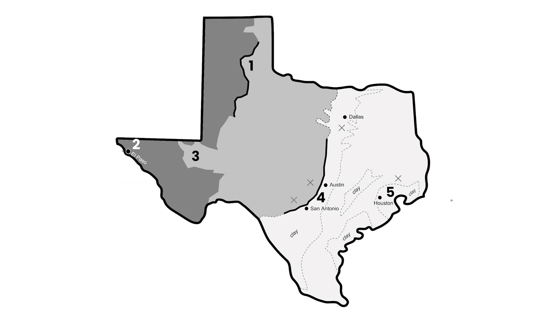
Find the key on your map. It tells you what the marks on the map
mean. Find the waves in the key and on the map. Those waves mean
water. Color the area around the waves blue on the key and the map.
mean. Find the waves in the key and on the map. Those waves mean
water. Color the area around the waves blue on the key and the map.
Please wait…
This video is having trouble loading. You may have lost your Internet connection.
Step 1: Click to Reload this page
Step 2: Click to
Try our other video player
Step 3: contact support if trouble persists.
Or,
dismiss this message.
Step
05/19
05/19
Find the numbers on the map that mark places where Flash Flood
Alley might be. If you find reasons that flash floods are likely at one of
these places, you’ll mark them on your Flash Flood Finder.
Alley might be. If you find reasons that flash floods are likely at one of
these places, you’ll mark them on your Flash Flood Finder.
Please wait…
This video is having trouble loading. You may have lost your Internet connection.
Step 1: Click to Reload this page
Step 2: Click to
Try our other video player
Step 3: contact support if trouble persists.
Or,
dismiss this message.
Step
06a/19
06a/19
Here’s the first clue to help you find Flash Flood Alley. Notice that the
parts of the map are different shades of gray. Look at the map’s key.
Discuss with your partner:
parts of the map are different shades of gray. Look at the map’s key.
Discuss with your partner:
Please wait…
This video is having trouble loading. You may have lost your Internet connection.
Step 1: Click to Reload this page
Step 2: Click to
Try our other video player
Step 3: contact support if trouble persists.
Or,
dismiss this message.
Step
06b/19
06b/19
The key shows the answer. Darkest gray is the highest land, where
there are tall mountains. Medium gray is lower land, where there are
hills, not mountains. Light gray is where the land is lowest.
there are tall mountains. Medium gray is lower land, where there are
hills, not mountains. Light gray is where the land is lowest.
Please wait…
This video is having trouble loading. You may have lost your Internet connection.
Step 1: Click to Reload this page
Step 2: Click to
Try our other video player
Step 3: contact support if trouble persists.
Or,
dismiss this message.
Step
07/19
07/19
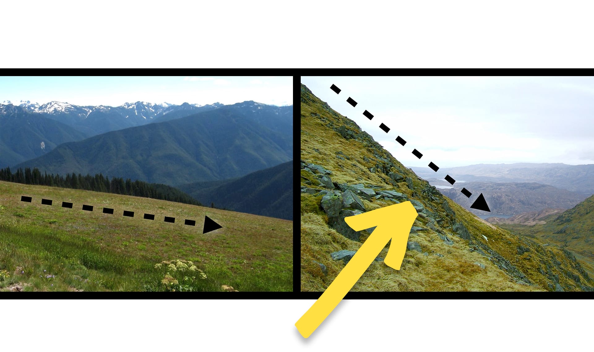
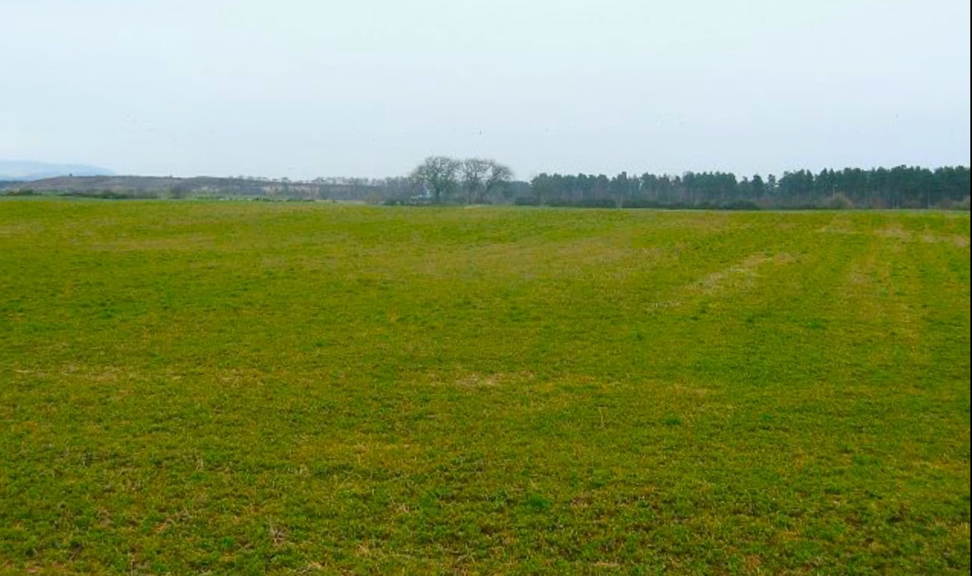
These pictures show you what you’d see if you traveled to the
highest land, the lower land, and the lowest land on your map. Think
about what would happen in each place after a rainstorm. Discuss:
highest land, the lower land, and the lowest land on your map. Think
about what would happen in each place after a rainstorm. Discuss:
Please wait…
This video is having trouble loading. You may have lost your Internet connection.
Step 1: Click to Reload this page
Step 2: Click to
Try our other video player
Step 3: contact support if trouble persists.
Or,
dismiss this message.
Step
08/19
08/19
On your map, find where two shades of gray meet. In those areas, a
lower place is next to a higher place. Look for numbers nearby.
Because water runs downhill, flash floods are likely in those locations!
lower place is next to a higher place. Look for numbers nearby.
Because water runs downhill, flash floods are likely in those locations!
Please wait…
This video is having trouble loading. You may have lost your Internet connection.
Step 1: Click to Reload this page
Step 2: Click to
Try our other video player
Step 3: contact support if trouble persists.
Or,
dismiss this message.
Step
09/19
09/19
On the Flash Flood Finder's key, a triangle symbol means a lower place
is near a higher place. Draw a triangle by each number in a lower
place near a higher place. Flash floods are more likely in those places.
is near a higher place. Draw a triangle by each number in a lower
place near a higher place. Flash floods are more likely in those places.
Please wait…
This video is having trouble loading. You may have lost your Internet connection.
Step 1: Click to Reload this page
Step 2: Click to
Try our other video player
Step 3: contact support if trouble persists.
Or,
dismiss this message.
Step
10/19
10/19
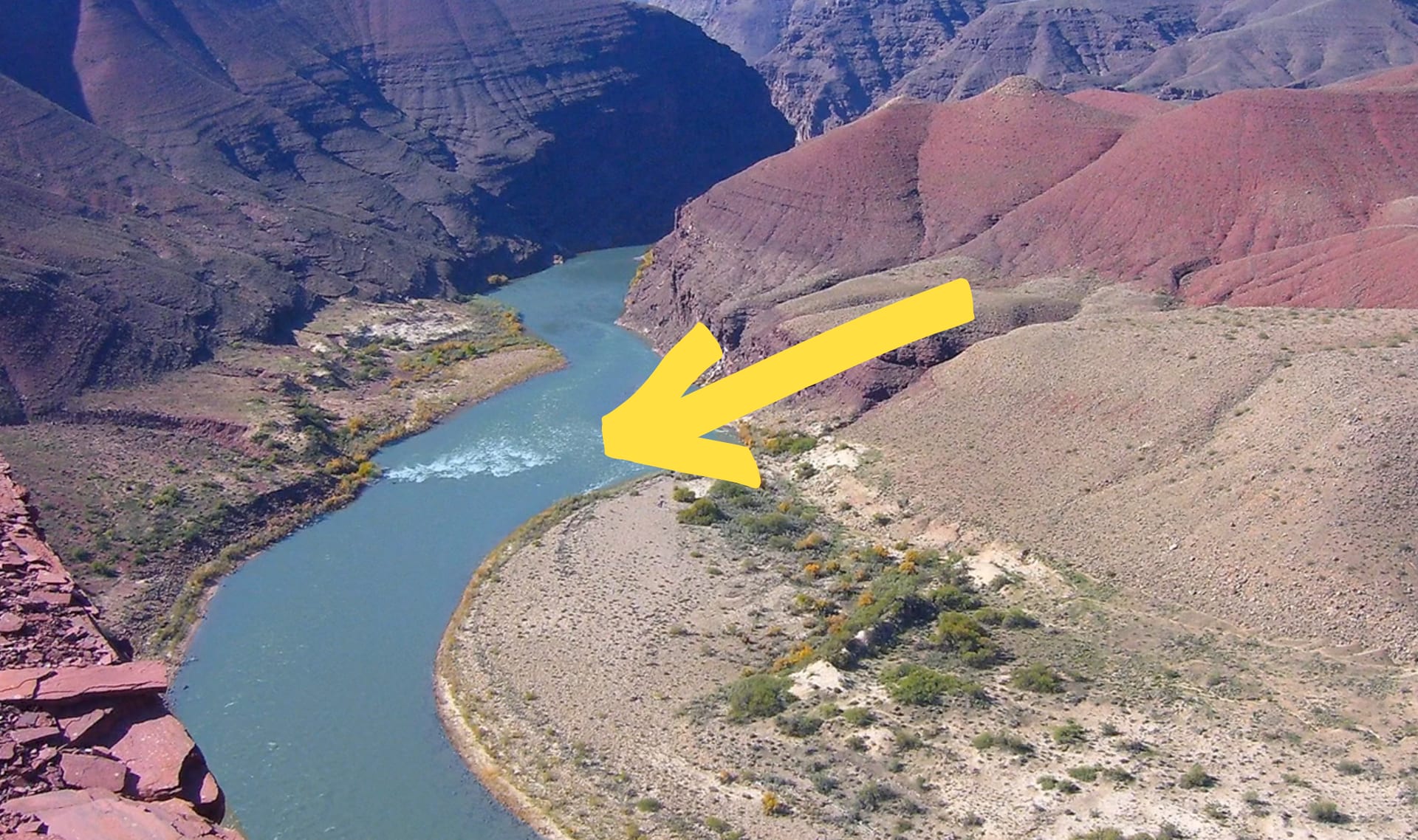
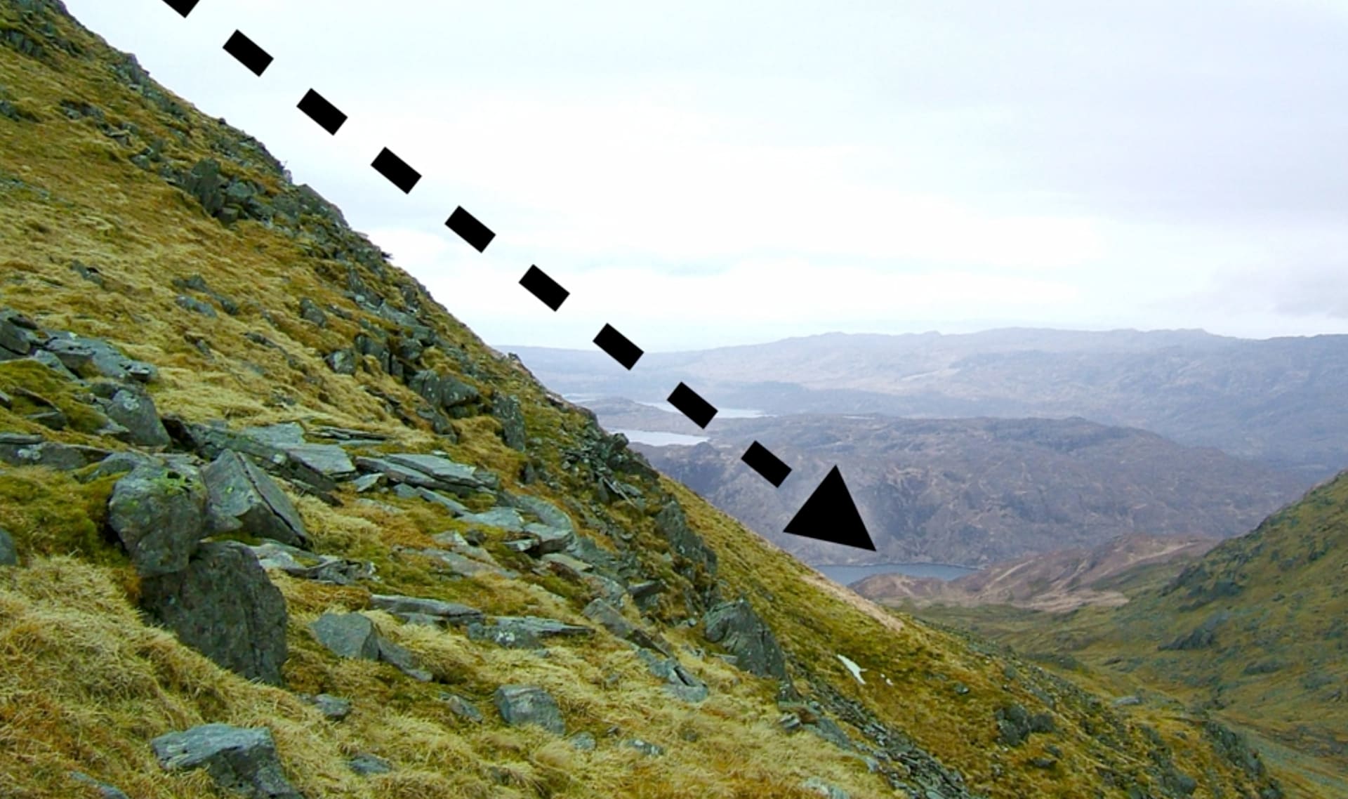
On your map’s key, find the line that marks where there are cliffs.
Draw an arrow to show water flowing down the cliff. Work with your
partner & draw arrows for water flowing down cliffs on your map.
Draw an arrow to show water flowing down the cliff. Work with your
partner & draw arrows for water flowing down cliffs on your map.
Please wait…
This video is having trouble loading. You may have lost your Internet connection.
Step 1: Click to Reload this page
Step 2: Click to
Try our other video player
Step 3: contact support if trouble persists.
Or,
dismiss this message.
Step
11/19
11/19
Flash floods are more likely at the bottom of cliffs and rocky slopes.
On your map, look for numbers that are near cliffs. On your Flash
Flood Finder, put an arrow pointing down by those numbers.
On your map, look for numbers that are near cliffs. On your Flash
Flood Finder, put an arrow pointing down by those numbers.
Please wait…
This video is having trouble loading. You may have lost your Internet connection.
Step 1: Click to Reload this page
Step 2: Click to
Try our other video player
Step 3: contact support if trouble persists.
Or,
dismiss this message.
Step
12/19
12/19
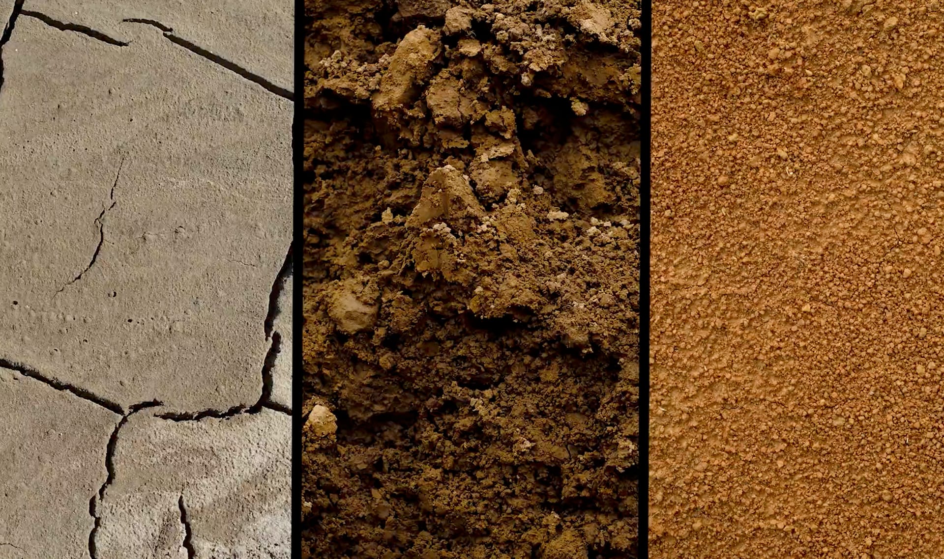
On your map’s key, find the shape beside the words “Clay soil.” Use
your yellow crayon to color in the shape. Then find all the areas on
the map that have the word “clay” and color those areas yellow.
your yellow crayon to color in the shape. Then find all the areas on
the map that have the word “clay” and color those areas yellow.
Please wait…
This video is having trouble loading. You may have lost your Internet connection.
Step 1: Click to Reload this page
Step 2: Click to
Try our other video player
Step 3: contact support if trouble persists.
Or,
dismiss this message.
Step
13/19
13/19
On your Flash Flood Finder’s key, color the square beside “clay soil”
yellow. On your map, look for numbers near areas with clay soil. On
your Flash Flood Finder, draw a yellow square by those numbers.
yellow. On your map, look for numbers near areas with clay soil. On
your Flash Flood Finder, draw a yellow square by those numbers.
Please wait…
This video is having trouble loading. You may have lost your Internet connection.
Step 1: Click to Reload this page
Step 2: Click to
Try our other video player
Step 3: contact support if trouble persists.
Or,
dismiss this message.
Step
14/19
14/19
On your map’s key, find the symbol for “City.” The circle around the
dot shows the city’s pavement. Color the circle red. On your map,
make a red circle the size of the one in the key around each city.
dot shows the city’s pavement. Color the circle red. On your map,
make a red circle the size of the one in the key around each city.
Please wait…
This video is having trouble loading. You may have lost your Internet connection.
Step 1: Click to Reload this page
Step 2: Click to
Try our other video player
Step 3: contact support if trouble persists.
Or,
dismiss this message.
Step
15/19
15/19
On your Flash Flood Finder’s key, color the circle beside “pavement”
red. On your map, look for numbers near areas with lots of pavement.
On your Flash Flood Finder, draw a red circle by those numbers.
red. On your map, look for numbers near areas with lots of pavement.
On your Flash Flood Finder, draw a red circle by those numbers.
Please wait…
This video is having trouble loading. You may have lost your Internet connection.
Step 1: Click to Reload this page
Step 2: Click to
Try our other video player
Step 3: contact support if trouble persists.
Or,
dismiss this message.
Step
16/19
16/19
On the map, find four places marked with an X. Each X marks where
there was a giant rainstorm. Draw a blue cloud over the X in the key
and the Xs on the map.
there was a giant rainstorm. Draw a blue cloud over the X in the key
and the Xs on the map.
Please wait…
This video is having trouble loading. You may have lost your Internet connection.
Step 1: Click to Reload this page
Step 2: Click to
Try our other video player
Step 3: contact support if trouble persists.
Or,
dismiss this message.
Step
17/19
17/19
On your Flash Flood Finder’s key, color the cloud beside “Giant
rainstorm” blue. On your map, look for numbers near the rainstorms.
On your Flash Flood Finder, draw a blue cloud by those numbers.
rainstorm” blue. On your map, look for numbers near the rainstorms.
On your Flash Flood Finder, draw a blue cloud by those numbers.
Please wait…
This video is having trouble loading. You may have lost your Internet connection.
Step 1: Click to Reload this page
Step 2: Click to
Try our other video player
Step 3: contact support if trouble persists.
Or,
dismiss this message.
Step
18/19
18/19
Now take a look at your map and your Flash Flood Finder.
Discuss:
Discuss:
Please wait…
This video is having trouble loading. You may have lost your Internet connection.
Step 1: Click to Reload this page
Step 2: Click to
Try our other video player
Step 3: contact support if trouble persists.
Or,
dismiss this message.
Step
19/19
19/19
Here’s what our Flash Flood Finder looks like.
Look at your map and discuss with your partner:
Look at your map and discuss with your partner:
Please wait…
This video is having trouble loading. You may have lost your Internet connection.
Step 1: Click to Reload this page
Step 2: Click to
Try our other video player
Step 3: contact support if trouble persists.
Or,
dismiss this message.

river
1 of 17
a long, thin area of water that flows
flood
2 of 17
an overflow of water
Please wait…
This video is having trouble loading. You may have lost your Internet connection.
Step 1: Click to Reload this page
Step 2: Click to
Try our other video player
Step 3: contact support if trouble persists.
Or,
dismiss this message.
flash flood
3 of 17
an overflow of water that happens very fast
Please wait…
This video is having trouble loading. You may have lost your Internet connection.
Step 1: Click to Reload this page
Step 2: Click to
Try our other video player
Step 3: contact support if trouble persists.
Or,
dismiss this message.
rain
4 of 17
water drops that fall from clouds
Please wait…
This video is having trouble loading. You may have lost your Internet connection.
Step 1: Click to Reload this page
Step 2: Click to
Try our other video player
Step 3: contact support if trouble persists.
Or,
dismiss this message.
storm
5 of 17
weather that usually includes strong wind and rain or snow
soil
6 of 17
tiny pieces of rock and other materials that cover the ground
Please wait…
This video is having trouble loading. You may have lost your Internet connection.
Step 1: Click to Reload this page
Step 2: Click to
Try our other video player
Step 3: contact support if trouble persists.
Or,
dismiss this message.
sandy soil
7 of 17
a type of soil that has a rough texture; water easily flows through it
Please wait…
This video is having trouble loading. You may have lost your Internet connection.
Step 1: Click to Reload this page
Step 2: Click to
Try our other video player
Step 3: contact support if trouble persists.
Or,
dismiss this message.
clay soil
8 of 17
a type of soil that has a smooth texture; water does not easily flow through it
Please wait…
This video is having trouble loading. You may have lost your Internet connection.
Step 1: Click to Reload this page
Step 2: Click to
Try our other video player
Step 3: contact support if trouble persists.
Or,
dismiss this message.
absorb
9 of 17
to soak up liquid, like a sponge does
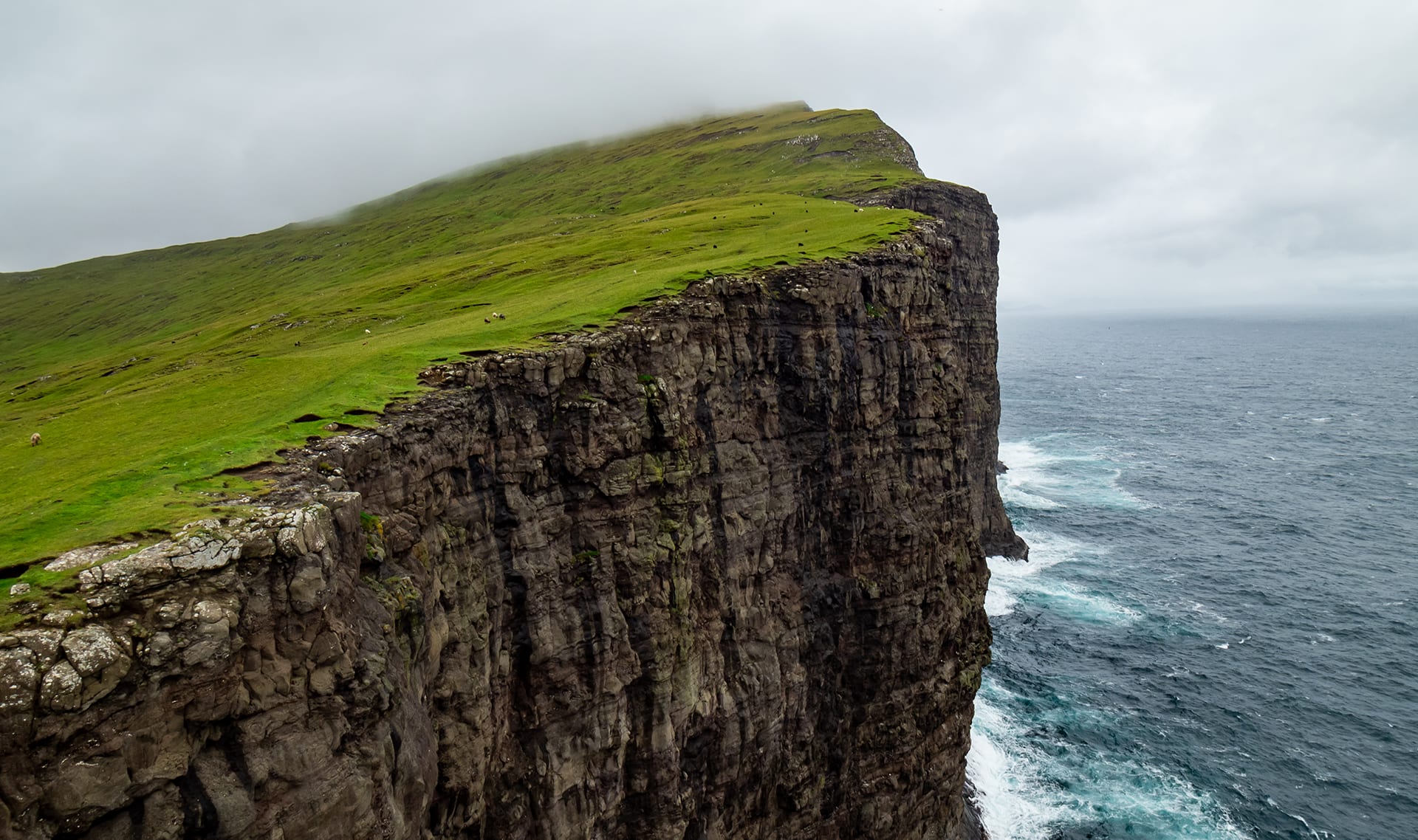
cliff
10 of 17
a high area of land with a side that is almost straight up-and-down
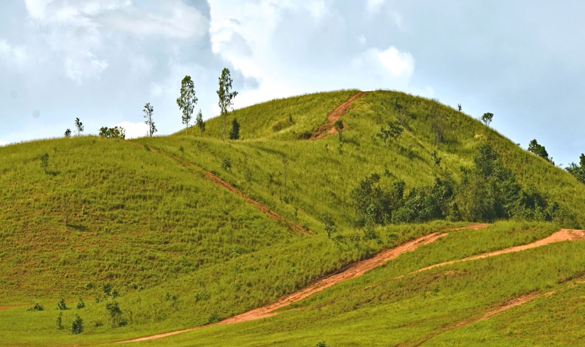
hill
11 of 17
a high area of land that isn't as tall as a mountain
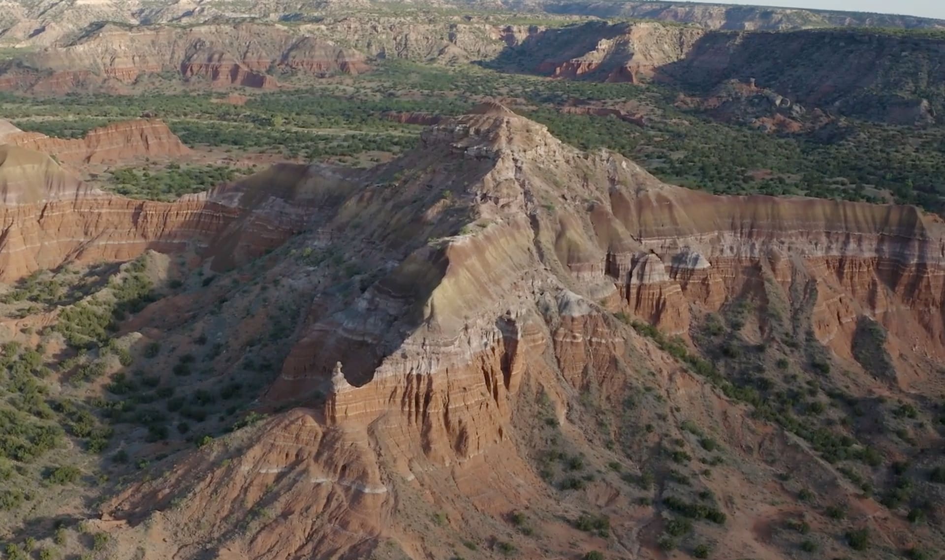
mountain
12 of 17
a high area of land with steep sides
slope
13 of 17
where one side is higher than the other
steep
14 of 17
something that is very high up on one end and very low at the other end
plains
15 of 17
large areas of flat land with few trees
map
16 of 17
a picture that shows the features of a place and where those features are
model
17 of 17
a pretend version of something that scientists use when the real thing is too big, small, or complicated to work with
🎉
That’s it for this lesson! How did it go?
Sign up now for more great lessons!